Why the geologist who studies earthquakes fell into 'deep learning'
15 years after a magnitude 9.1 earthquake and tsunami struck off the coast of Indonesia , killing more than 200,000 in more than a dozen countries, geologists are still trying to understand the complex fault system in the crust.
Geologists can easily find major faults, but these large-scale features are linked to small faults or cracks in the rock. Tiny faults are quite difficult to identify, as they can only be identified by studying the individual pieces through 3D images over several weeks.
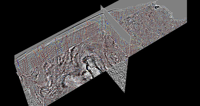
Researchers at the University of Texas at Austin, Texas, USA, are revolutionizing this complex process with a deep learning model that identifies seismic fault systems from 3D seismic imagery, saving researchers time and resources. Developers used a combination of NVIDIA GPUs and synthetic data to train neural networks to discover tiny, microscopic faults that most geologists miss.
Examining fault systems can help determine which features are older than others and help study areas of interest, such as the periphery of a continent where a continental plate meets an oceanic plate.
Seismic research is also used in drilling operations in the energy industry to extract oil and natural gas, and it is also used in the opposite process of carbon sequestration: by injecting carbon dioxide back into the ground to mitigate the effects of climate change.
“With deep learning, we don't just get a little bit more accuracy, but it gives us a whole other level of accuracy and efficiency,” said Sergey Fomel, professor of geology at the University of Texas at Austin. There are times to do it, and there are times when you shouldn't. Either way, the first thing you need to do is break the location of the cracks.”
Deep learning: Top-level crack tracking
Seismic fault systems are so complex that manual analysis of relevant data can miss microscopic cracks or long fissures associated with major faults. Deep learning models trained on human annotated datasets miss these little cracks as well.
To address this problem, the researchers created synthetic data of seismic faults. Using synthetic data meant that scientists already knew the location of each major and minor fault in the data set. With this ground-truth baseline, scientists were able to train an AI model that provided higher accuracy than manual labeling.
The team's deep learning model analyzes 3D volumetric data to calculate the probability that a fault exists for every pixel in the image. Then, geologists review and analyze where the neural network has marked faults likely.
“Geologists study what happened in geological times,” Pomel said. We need to analyze the results of our AI models to see what exactly happened, but we want to help geologists avoid doing this manually. Geologists shouldn't waste their time doing manual work.”
Prof Pomel said that analyzing a tomographic system with the team's CNN -based model making inferences with NVIDIA GPUs could take up to a month if done manually, which would take only seconds to analyze a tomographic system. Previous automation methods took several hours and significantly reduced accuracy.
Professor Pomel said, “With deep learning, we don't just get a little bit of accuracy, but we can provide a whole other level of accuracy and efficiency. Deep learning is a game changer in the field of automatic analysis.”
The researchers trained their neural network on a Maverick2 system at the Texas Advanced Computing Center powered by NVIDIA GPUs . The researchers' deep learning models were created using PyTorch and TensorFlow deep learning frameworks, and a Madagascar software package was used for geophysical data analysis.
In addition to faults, the algorithm can also be used to detect other features studied by geologists, such as salt bodies, sedimentary layers and channels. Researchers are also developing neural networks that calculate geological ages based on seismic data, the measurement data that can provide detailed information about the geological structure.


Comments